Shaping of the Land
The Land Takes Shape through Ice and Fire
This particular place we now call Heatherhope Farm is now over four billion years old, and has seen many changes. Once part of a supercontinent, its original fire-born rocks weathered and eroded while the drifting plates tore this region apart and formed rifts and long, narrow troughs. Then, starting about a half billion years ago, and continuing for about 200 million more, the ground sank slowly and Heatherhope took its place at the bottom of a huge shallow sea. The sea itself gave birth to a thick layer of sand, which mixed with animal shells and coral and produced the limestone layer beneath our topsoil; and just about a half mile to our south is a limestone quarry that has given up its wealth for the sweetening of soils and the building of modern buildings and roadways.
Next to shape this land, between 323 and 1.8 million years ago, oceans came and went and birthed swamps and coal, oil and gas around us, but Heatherhope was rolling, with a river or two cutting the land surface.
Then came the glaciers. From 1.6 million to about 10,000 years ago the ice came and went—at times up to 2,000 feet thick, it was an unimaginably powerful force. And no one knows exactly what brought on the cold. It could have been shifts of the earth’s magnetic field or orbit or tilts of the axis or shifts of the Gulf Stream, or volcanic activity or all of the above. But all around Heatherhope the land was leveled; but we are on a slope of a ridge, cut by a massive river of melting ice that has shrunk over ten millennia to what we call the Kishwaukee River. The south branch of that river runs just about 1,000 yards or six tenths of a mile to our east. Everyone around here owes their lives to the waters of that river and others that carry water on to the Rock River, the Illinois, and the Mississippi to the Gulf of Mexico, and to the ancient streams below the ground that are also necessary for life, but that are mostly out of sight and so out of mind.
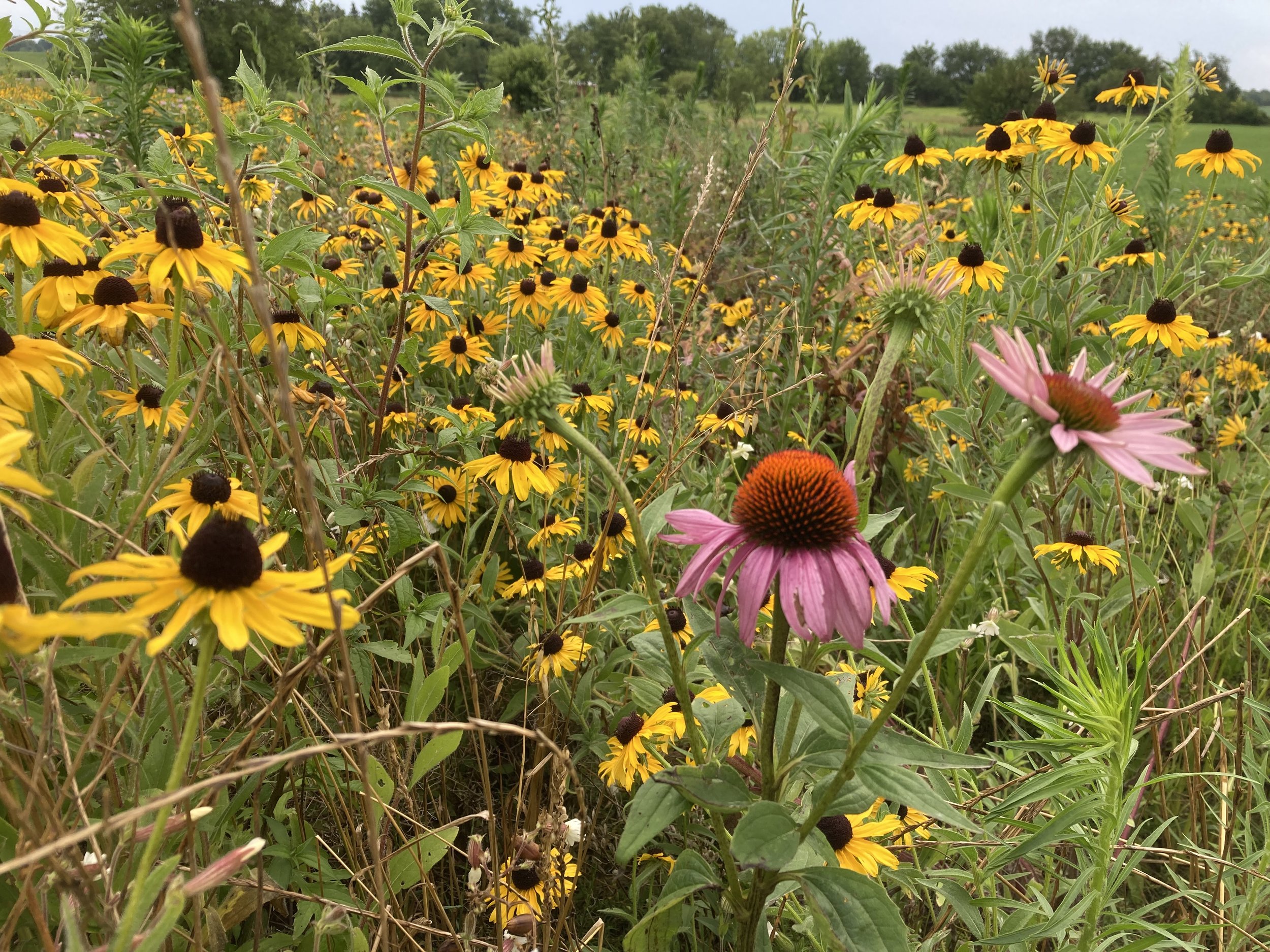
After the ice and the waters came the fire. To this day the climate at Heatherhope produces hot, dry, and windy summers and cold, wet, and windy winters. For more thousands of years this collision of extremes formed the prairies; and Heatherhope is now classified as part of the Grand Prairie Division of the State of Illinois. The native prairie vegetation sent down deep roots that were out of reach of the frequent flames. The flames did kill off the trees not in wet lands, and cleared the land of dead plant thatching, and the prairie plants thrived and produced some of the most fertile soils this world has seen. Tragically though, Illinois, the Prairie State, has only 0.01% of it’s native prairie ecosystem left. At Heatherhope we are following the lead of our next-door neighbors, and working to restore native prairie plants to two small sections of our property. We hope prairies have a future, since native plants of this type are well adapted to the hot and dry conditions and frequent fires that are coming our way due to climate change.